This guide covers where to find your log files in each major drone app, and then exactly how to import them into UK Drone Map's free, privacy-first logbook. Everything runs in your browser — your files are never uploaded anywhere.
Step 1 — find your log files
Different apps store logs in different places. Here's where to look for each one:
DJI Fly (DJI Mini 2, Mini 3, Mini 4 Pro, Air 3, Mavic 3)
Two ways to get your files:
- In-app export (recommended): Open DJI Fly → tap your profile icon → Flight Records. Tap the three-dot menu on any flight → Export. You can export as CSV (summary) or KML (track). On most devices you can share or save to Files from here.
- Raw .TXT files (Android): Connect your phone, open
Internal Storage → DJI → FlightRecord. Files namedDJIFlightRecord_YYYY-MM-DD_[hash].txtare per-second telemetry CSVs with#-prefixed metadata headers. UK Drone Map strips these and reads the data rows automatically.
Tip: The raw .TXT files contain more data (precise GPS track, full telemetry) than the in-app summary CSV export. If you have them, import those for better location data.
DJI GO 4 (Phantom 4, Mavic Pro, Spark)
The raw FlightRecord .TXT files are in the same location (DJI/FlightRecord on Android). The in-app export CSV from GO 4 has the same format as Fly — both work.
Autel Explorer / Autel Sky (Autel EVO, Nano, Lite)
Open the Autel Sky app → Flight Records → tap any flight → Export or Share. The exported CSV contains per-second rows with a height(m) column, which UK Drone Map detects automatically and converts to feet. If your version doesn't have a per-flight export, try Export All from the main Records screen.
Skydio (Skydio 2, Skydio X2)
In the Skydio app, go to Flight Log → select a flight → Export CSV. The file includes start_time, flight_duration_s and max_altitude_m columns, all of which UK Drone Map maps automatically with unit conversion.
Kittyhawk, Hover, FlightLogger
All three apps have a CSV export option in their logbook or flight history section. The column names vary but UK Drone Map's Generic CSV parser covers over 50 aliases — as long as your export includes a date column it will produce log entries. Export from the app's web dashboard for the most complete data.
DroneLogbook (JSON export)
In DroneLogbook, go to Logbook → Export → JSON. The exported file contains a flights array that UK Drone Map reads directly. Date, duration, altitude, aircraft and location fields are all mapped automatically.
Any app with KML or GPX export
Litchi, DroneDeploy, Map Pilot, Pix4D and most other flight planning apps can export KML or GPX track files. KML is preferred if available — it includes altitude data and, where present, TimeSpan elements with the exact date and duration of the flight.
Step 2 — open Fleet → Logs on UK Drone Map
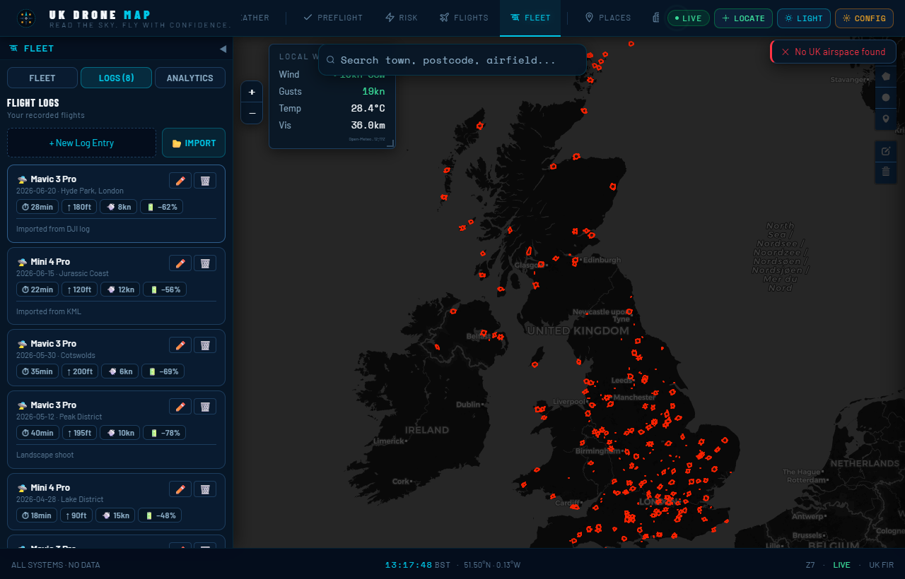
Open ukdronemap.app, tap Fleet in the sidebar, then select Logs from the nav row at the top of the Fleet panel.
Step 3 — click Import and select your files
Tap the 📂 Import button. A file picker opens. Select one or more files — you can mix formats in a single selection. The picker accepts .csv, .txt, .kml, .gpx and .json files.
Step 4 — review the preview
After parsing, UK Drone Map shows you a preview list of every flight found — date, aircraft, location, duration, max altitude and battery. Nothing has been saved yet. Check the entries look correct before confirming. If a file failed to parse (wrong format or empty) you'll see an error card in the preview.
Step 5 — confirm the import
Hit "IMPORT N FLIGHTS". The importer deduplicates — any new entry whose date + aircraft + duration matches an existing log is skipped. You'll see a summary: how many were imported and how many were duplicates.
If you also want to download a backup immediately, use "IMPORT & EXPORT BACKUP" instead — this imports and immediately triggers a Fleet Data export file.
After import: what the Analytics tab shows
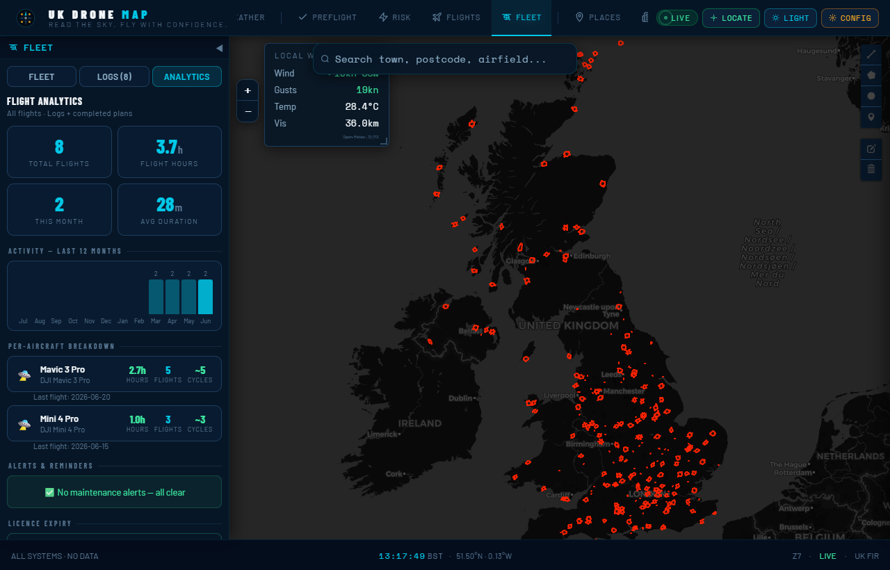
Switch to the Analytics tab to see everything computed from your imported flights:
- Total flights and hours — lifetime totals with a 12-month activity chart
- Per-aircraft breakdown — hours, flight count and approximate battery cycles per drone
- Maintenance alerts — props check at 50 h, full service at 100 h, battery replacement warning at 100–150 cycles
- Licence expiry warnings — A2 CofC, GVC and insurance dates with countdown
All of this runs entirely in your browser against your local data. No server, no account, no subscription.
Start importing at ukdronemap.app → Fleet → Logs. Free, no sign-up, nothing leaves your device.